The Biggest Earthquakes in History


The most powerful earthquakes in history are the Valdivia earthquake in Chile (1960), the Indian Ocean earthquake (2004), Alaska earthquake in US (1964), Tōhoku earthquake in Japan (2011), Severo-Kurilsk earthquake in Russia (1952), Lima–Callao earthquake in Peru (1746), Arica earthquake in Chile (1868), Cascadia earthquake in USA (1700), Chile earthquake (2010) and Ecuador-Colombia earthquake (1906).
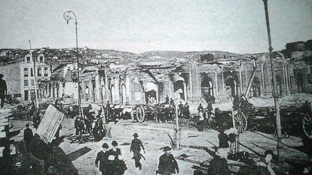
An earthquake is a natural phenomenon that occurs due to a sudden release of energy accumulated in the inner layers of the Earth's crust. This release of energy causes the generation of seismic waves that propagate across the Earth's surface. These movements can vary in intensity, from barely perceptible tremors to violent quakes capable of decimating entire cities. Quantifying the biggest earthquakes in history is difficult, but the earthquakes we share here are considered the most devastating due to being the most powerful and causing the most damage. thedailyECO shares these Earthquakes with photos where possible.
- Valdivia earthquake in Chile (1960)
- Indian Ocean earthquake (2004)
- Alaska earthquake in the United States (1964)
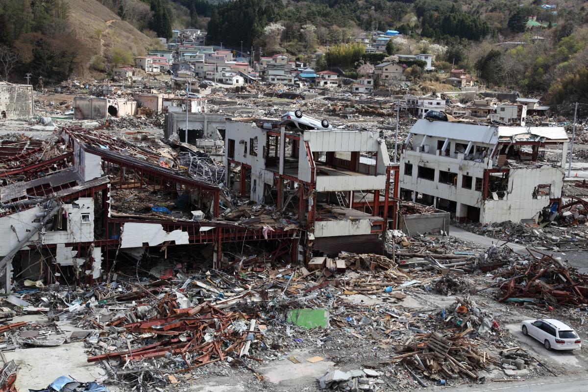
- Tōhoku earthquake in Japan (2011)
- Severo-Kurilsk earthquake in Russia (1952)
- Lima–Callao earthquake in Peru (1746)
- Arica earthquake in Chile (1868)
- Cascadia earthquake in United States (1700)
- Earthquake in Chile (2010)
- Ecuador-Colombia earthquake (1906)
Valdivia earthquake in Chile (1960)
This earthquake occurred on Sunday, May 22, 1960. In just a few seconds, it became the largest earthquake that has been recorded up to that point in history with a magnitude of 9.5 Mw. For comparison, scientists noted that the energy released during this earthquake was 20,000 times stronger than the Hiroshima bomb. The worst of all was not the earthquake itself. About 15 minutes after the shock, a tsunami occurred as a result of the vibrations.
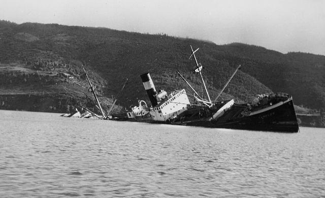
The tsunami had waves up to 10 meters high that devastated much of the south of the country. The earthquake was of such magnitude that it produced topographical changes to the map of Chile. All the river beds were modified and large portions of land sank, changing the map significantly. Among the consequences of the Valdivia earthquake were more than 2,000 people dead, severe damage to roads and buildings and millions of victims. As can be seen in the photo below, the tsunami caused the sinking of many vessels of the Chilean coast

Indian Ocean earthquake (2004)
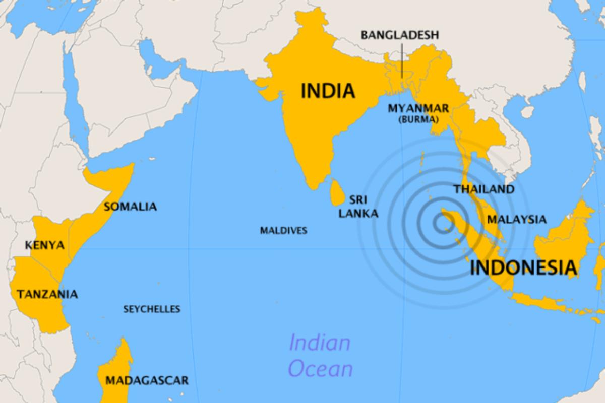
The second biggest earthquake in the world had an intensity of 9.3 Mw. Due the faults affected by the earthquake being oriented north to south, the maximum strength of the tsunami wave was directed towards Bangladesh instead of Sumatra on the other side. This avoided further consequences for the Indonesian islands.
Due to the distance, the tsunamis took between fifteen minutes and seven hours to reach the coasts of the different countries that were affected. In addition to the direct impact of the waves, the effects of the tsunami were also felt as far away as Struysbaai in South Africa, about 8,500 kilometers from the epicenter. Tides rose by 1.5 meters approximately 16 hours after the tsunami at this location. The tsunami also reached Antarctica, where researchers at Japan's Showa Scientific Base recorded fluctuations of up to one meter for several days after the initial shock.
Discover more about other natural disasters with our related article on how hurricanes are formed.

Alaska earthquake in the United States (1964)
Although further down on the list of the world's most powerful earthquakes, this the 1964 Alaska earthquake had a magnitude of 9.2 Mw, only 0.1 of a magnitude less. As it fell on the Friday before Easter Sunday, it is sometimes known as the Good Friday Earthquake of 1964.
At 5:36 p.m. on March 27, 1964, the ground began to move between the most populated Alaskan cities of Anchorage and Valdez in an unprecedented manner. The earthquake lasted four minutes, causing the towns near the epicenter to be almost completely destroyed. Anchorage also suffered major infrastructure damage with the airport, downtown and hundreds of square miles of buildings and residential areas destroyed.
Due to Alaska's low population density, the earthquake itself had a relatively low death toll of 60 people. Immediately after the earthquake, the seawater on the coast near the epicenter began to retreat abruptly and an hour later it returned with enormous force. The 1964 Alaska earthquake and tsunami caused more than a dozen giant waves and destroyed entire coastal cities. The largest wave, which occurred an hour after the earthquake, reached 67 meters high in Shoup Bay and wiped out the town of Chenega and its 68 residents.
Tōhoku earthquake in Japan (2011)
This earthquake caused a tsunami nine meters high that damaged several nuclear reactors in the area with a magnitude of 9.1 Mw. This makes the the Tōhoku earthquake the largest earthquake in the history of Japan.
The total number of confirmed fatalities and missing persons rose to more than 22,500, with almost 20,000 dead and 2,500 missing, according to the Japan Fire Agency. The deaths were caused by the initial earthquake and tsunami, as well as health conditions following the disaster.
The material damage caused by the earthquake and tsunami is estimated at approximately 25 trillion yen (approximately 300 billion US dollars). The Japanese government estimates that the tsunami washed nearly 5 million tons of debris offshore, but 70% of it sank and only 1.5% remained. Billions of tons floated into the Pacific Ocean. Some of the destruction can be seen in the photo below.

Severo-Kurilsk earthquake in Russia (1952)
The 1952 Severo-Kurilsk earthquake occurred off the coast of the Kamchatka Peninsula at 4:58 am on November 5, 1952. The magnitude 9.0 Mw earthquake triggered a massive tsunami that struck Severotrielsk, the Kuril Islands, the Oblast of Sakhalin, the Russian Soviet Federative Socialist Republic and the Russian Federation.
This led to the destruction of many settlements in the Sakhalin and Kamchatka regions, with the main impact being the city of Severo-Kurilsk. It was the fifth most powerful earthquake since 1900 and by far the most powerful in Russian history.
Lima–Callao earthquake in Peru (1746)
On October 28, 1746, one of the most powerful earthquakes in history shook the city of Lima. Although at the time there were no scientific records or measurements of the earthquake, based on the descriptions that have survived to this day and the damage caused, it was estimated that it had a magnitude of 9 Mw.
Arica earthquake in Chile (1868)
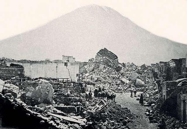
The earthquake caused serious damage in Arequipa, Morondo, Moquegua and other cities in southern Peru. It occurred on August 13, 1868 when Arica was under Peruvian sovereignty. Its brutal influence was evident in several areas of the city up until the end of the 19th century when it had already become part of Chilean territory.
Most measurements put the magnitude of the earthquake at around Mw 9 and it killed almost 600 people. 212 of them were sailors on ships in the bay, while the remaining 385 lived in the city. Other major earthquakes occurred in Arica during the 17th century, but less is known about them.

Cascadia earthquake in United States (1700)
The Cascadia earthquake of 1700 was a large earthquake with an estimated magnitude of 8.7 to 9.2 Mw, which occurred in the Cascadia subduction zone on January 26, 1700. The earthquake involved the Juan de Fuca and the Plate of the Pacific. This ranged from Vancouver Island in Canada to the northern coast of California in the United States. It is estimated that the scale of the fault rupture is about 1,000 kilometers and the slippage is at least 20 meters. This earthquake predated photography, so no photos exist.
Earthquake in Chile (2010)
The 2010 Chile earthquake was an earthquake with a magnitude of 8.8 Mw. The epicenter took place in the Chilean Sea, off the coast of what was then the Biobío Region, approximately 150 kilometers northwest of Concepción and 63 kilometers southwest of Cacones, at a depth of 30 meters under the Earth's crust. It is the second most recent largest earthquake in the world to be in the top 10.
The maximum duration in areas near the epicenter of the earthquake was 4 minutes. In Santiago, Chile, the maximum duration was more than 2 minutes. Varying degrees of intensity were felt in much of the Southern Cone, such as Buenos Aires and Sao Paulo in the east. As depicted in the photo below, the destruction caused entire buildings to be split in two.

Ecuador-Colombia earthquake (1906)
This earthquake also had a magnitude of 8.8 Mw. The epicenter was located in the Pacific Ocean, opposite the border between Ecuador and Colombia. It was one of the most powerful earthquakes ever recorded in the world, with the same magnitude as the Chile earthquake of February 27, 2010.
According to documents from the time, the earthquake caused the greatest damage in the towns of the department of Esmeraldas, Río Verde, Limones, La Tola and the Tumaco region in Colombia. The earthquake did not have catastrophic consequences for the aforementioned areas, since there were no large urban centers at that time. However, the damage spread to the northern provinces of the Ecuadorian Cordillera. Earthquake damage was felt from Cali, Colombia, to Otavalo, Ecuador.
Now you know the 10 biggest earthquakes in history, you may want to know how earthquakes occur thanks to our related guide.

If you want to read similar articles to The Biggest Earthquakes in History, we recommend you visit our Facts about nature category.
- Very interesting. (2020). This was the Alaska earthquake that caused a tsunami with waves 67 meters high. Retrieved from: https://www.muyinteresante.com.mx/medio-ambiente/3361.html
- CNN. (2019). This was the earthquake and tsunami that hit Japan in 2011; the deadliest in the country's history. Retrieved from: https://cnnespanol.cnn.com/2019/06/18/asi-fue-el-mortifero-terremoto-y-tsunami-que-azoto-a-japon-en-2011-el-mas-mortifero -in-the-history-of-the-country/
- Chilean memory. Earthquake and tsunami of August 13, 1868, Arica. Retrieved from: https://www.memoriachilena.gob.cl/602/w3-article-97954.html
- MINEDUC disaster risk reduction unit. The 2010 Chile earthquake. Retrieved from: https://emergenciaydesastres.mineduc.cl/el-terremoto-de-chile-de-2010/
- Geophysical Institute. (2012). ESMERALDAS EARTHQUAKE OF 1906 - ONE OF THE LARGEST EARTHQUAKES IN RECENT HISTORY. Retrieved from: https://www.igepn.edu.ec/servicios/noticias/575-terremoto-de-esmeraldas-de-1906-uno-de-los-sismos-m%C3%A1s-grandes-la-historia
- National Geographic. (2022). The 2004 Indian Ocean tsunami: the most devastating in history. Retrieved from: https://www.nationalgeographic.com.es/medio-ambiente/el-tsunami-de-2004-en-el-indico-el-mas-devastador-de-la-historia_19081
- BBC News World. (2020). Chile | Valdivia earthquake: what the powerful earthquake of 1960 was like, the largest in recorded history. Retrieved from: https://www.bbc.com/mundo/noticias-52704487

