What Are Lenticular Clouds?


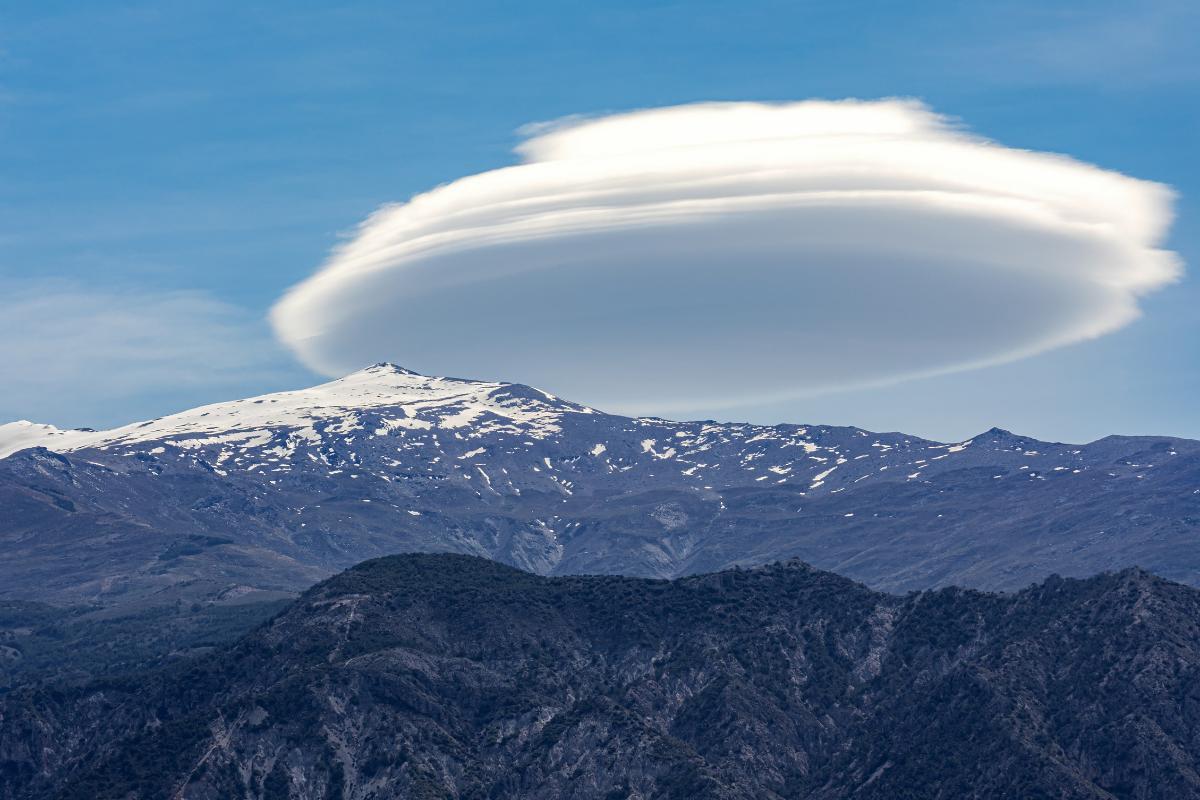
Have you ever gazed skyward and spotted a cloud that resembled a flying saucer or a giant contact lens? These captivating formations, known as lenticular clouds (or Altocumulus lenticularis for the science buffs), are a unique phenomenon often associated with mountainous regions. Their formation is a fascinating interplay between air movement and the Earth's topography.
This article by thedailyECO delves deeper into the science behind lenticular clouds, explaining how they form and why they appear the way they do.
What are lenticular clouds?
Lenticular clouds, named for their resemblance to lentils (a type of bean), are stationary-looking clouds with a distinctive lens or saucer shape. They most frequently appear in mountainous areas where stable air currents are forced to rise over mountain peaks.
Despite their seemingly static appearance, lenticular clouds are constantly moving with the air flowing through them. Their unique shape and often dramatic presence make them a favorite among skywatchers and photographers.
Ever wonder how clouds form? Learn the science behind their formation in this other article.

Characteristics of lenticular clouds
These clouds hold a unique charm due to several characteristics:
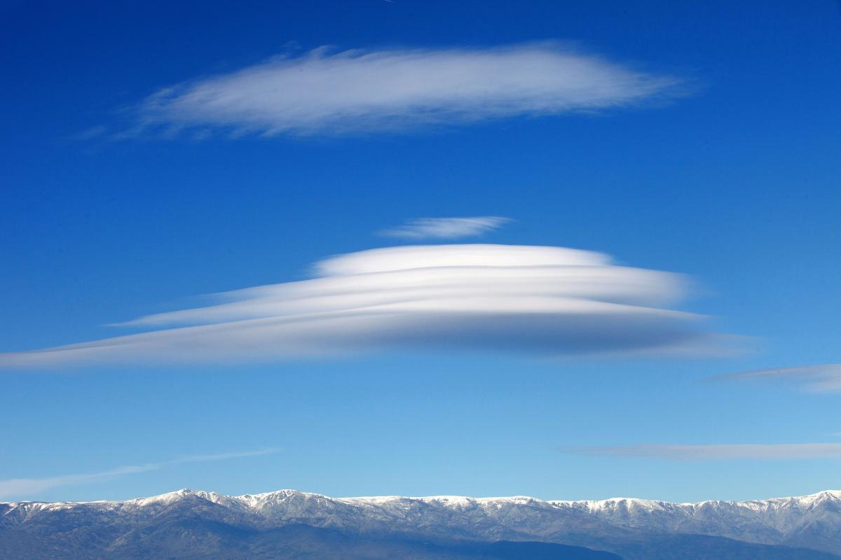
- Shape: distinctive lens or saucer shape, formed by atmospheric waves.
- Appearance: smooth and uniform texture compared to other cloud types.
- Illusion of stillness: can appear stationary for extended periods due to specific air conditions, despite constant internal air flow.
- Location: form over mountainous regions or where air encounters obstacles like buildings, but can appear at various altitudes.
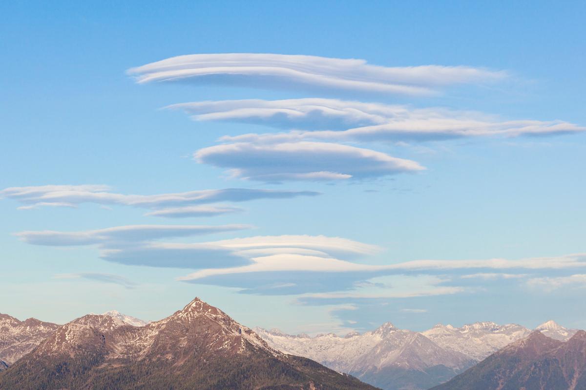
- Multiple layers: can sometimes be observed in multiple stacked layers due to successive atmospheric waves.
- Color: can display vibrant colors like red, orange, and pink during sunrise or sunset due to light interacting with water droplets or ice crystals.
- Iridescence: sometimes exhibit a rainbow-like iridescence caused by sunlight diffracting through water droplets of uniform size.
- Weather: not always indicative of bad weather, but their presence can sometimes suggest approaching warm fronts or areas of turbulence for experienced observers.
- Lifespan: can persist for extended periods, sometimes even hours, due to the continuous air flow that sustains their form.
- Safety: despite their dramatic appearance, lenticular clouds themselves don't pose any danger.
Have you ever been curious about how towering storm clouds form? Cumulonimbus clouds are the powerhouses behind thunderstorms, and this article by thedailyECO explains the fascinating science behind their creation.

How do lenticular clouds form?
The process begins with stable air currents, often influenced by prevailing winds or local conditions, moving steadily over a mountain range. As this air encounters the mountain, it's forced to rise upwards.
During this ascent, a phenomenon called adiabatic cooling takes place. Adiabatic cooling describes the decrease in temperature of an air mass as it expands with no heat transfer. Imagine a balloon expanding as it rises – the same principle applies to air. As the air mass expands with no heat transfer, it cools down. This drop in temperature plays a key role in cloud formation.
The rising air doesn't simply go straight up. Instead, it creates a series of atmospheric waves that resemble ripples in the atmosphere. These waves have crests and troughs, and it's at the crests where cloud formation occurs. As air reaches the crest of a wave, it experiences further cooling due to its position and the ongoing adiabatic cooling process. If this cooling is sufficient, and the humidity reaches a critical point called the dew point, the stage is set for cloud formation.
When the cooled air at the crest of the wave reaches its dew point, the water vapor condenses into tiny water droplets or ice crystals, depending on the temperature. This process of condensation gives birth to the lenticular cloud. The unique lens or saucer shape arises from the interaction between the airflow, the wave pattern, and the condensation zone. It's as if the cloud is sculpted by these invisible forces.
While mountainous regions are a common setting for lenticular cloud formations, it's important to note that they're not the only location. These clouds can also form over other obstacles, such as buildings or even tall structures, whenever the conditions for stable airflow, rising air, and cooling are met.
Sometimes, you might encounter lenticular clouds stacked in multiple layers, one above the other. This phenomenon occurs when there are successive atmospheric waves present, each with its own crest and condensation zone, leading to the formation of multiple lenticular clouds at different altitudes.
Do these captivating lenticular clouds leave you wanting to see more? The world of cloud formations is vast and wondrous. Explore another fascinating phenomenon the "sea of clouds" and learn how it forms.
If you want to read similar articles to What Are Lenticular Clouds?, we recommend you visit our Meteorological phenomena category.


