What Is Virga in Weather?


Also known as a dry storm, the virga weather phenomenon occurs when a visible amount of precipitation can be seen falling from the sky, but it does not reach the ground. This meteorological phenomenon can be seen with reactively regularity, but not many people are aware of it. It is particularly common in desert and temperate climates. Although they may go unnoticed by many, virga clouds are formed by a unique process of precipitation. It is a direct result of interactions between upper and lower parts of the Earth's atmosphere.
In this thedailyECO article, we explain what is virga in weather? In addition to providing a definition, we explain how virga clouds are formed and how they dissipate.
What is virga in weather?
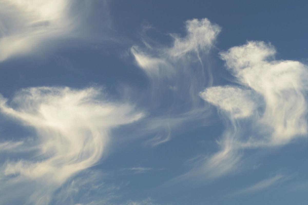
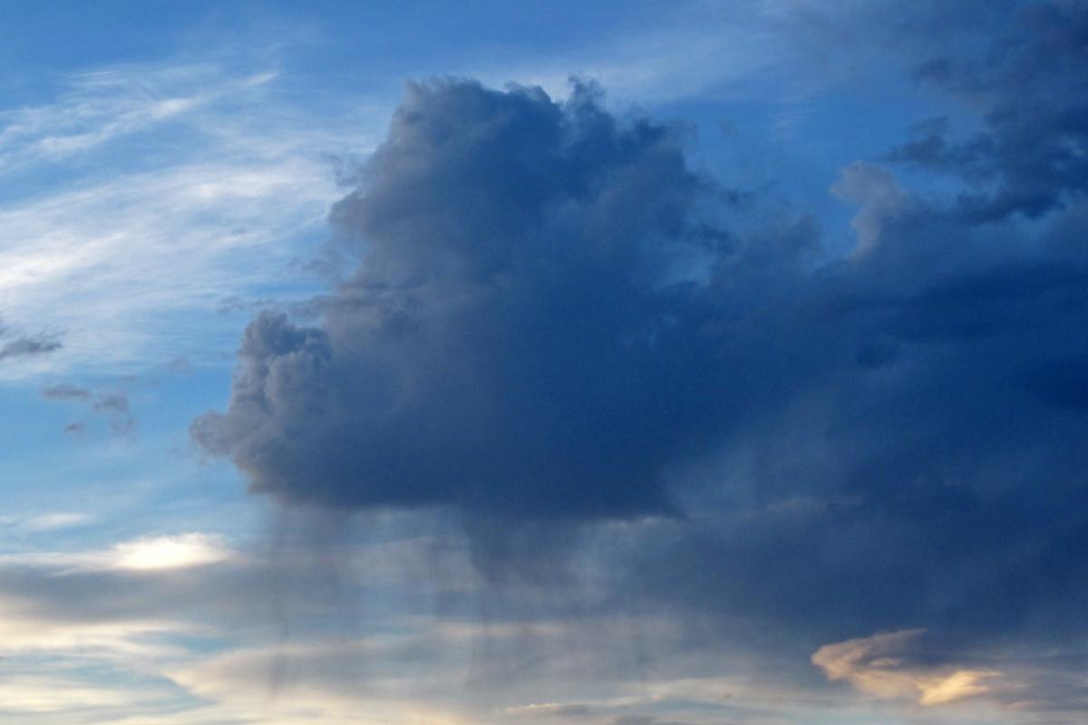
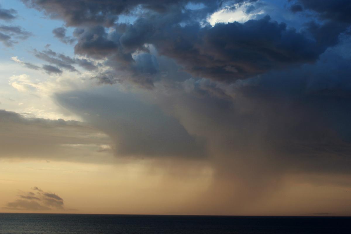
Virga is a meteorological phenomenon that refers to the fall of precipitation which never reaches the ground. Such precipitation is usually in the form of rain or snow. This means that the rain does fall from the clouds to the lower part of the atmosphere, but it never reaches the Earth's surface. This occurs because the rain or snow either evaporates or sublimates during its fall. It is for this reason it also known as a dry storm.
This phenomenon occurs when raindrops or snow crystals form in clouds at a considerable altitude. During their descent, they encounter atmospheric conditions that favor evaporation or sublimation before reaching the ground. This can be due to several factors, such as the presence of dry air in the lower layers of the atmosphere or heating of the surrounding air that evaporates the droplets before they reach the surface.

Where does virga occur?
Virga is commonly observed in arid regions or in climates where humidity in the lower layers of the atmosphere is low. Although the precipitation does not reach the ground, the virga can be indicative of the presence of vertically developing clouds. These include cumulonimbus or storm clouds, i.e. clouds which are capable of generating precipitation. The difference is that conditions in the lower layer prevent it from actually reaching the surface.
Meteorologically, virga may be an important component in understanding climate patterns and atmospheric dynamics. Furthermore, its observation can have impacts on weather prediction. This is because the presence of virga indicates the possible formation of clouds and the potential for adverse weather conditions developing in the region.
Learn more about how cumulonimbus clouds form with our related guide.
How is virga formed?
The formation of virga involves several specific atmospheric processes and conditions that affect raindrops or snow crystals as they descend from the clouds. These are the atmospheric conditions that must be met for virga to form:
- Cloud formation: the first phase begins with the formation of clouds in the atmosphere. Clouds are generated when moist air rises and then cools. When this happens, the water vapor contained in the air condenses into small water particles or ice crystals (as with rain or snow, respectively). These particles group together to form clouds. You can learn more about how clouds are formed in general.
- Vertical development of clouds: for virga to occur, it is common for clouds to be vertically developed, such as cumulonimbus storm clouds. These clouds can extend to great heights in the atmosphere.
- Growth of raindrops or snow crystals: within these clouds, raindrops or snow crystals continue to grow as they collide and merge with other particles. In the case of rain, droplets can grow by coalescence, where they merge with other smaller droplets. Learn more about rain formation with our article on what is a torrential downpour?
- Descent from the cloud: the raindrops or snow crystals are now larger. Due to their weight, gravity causes them to begin to descend from the cloud. As they descend, they are subject to the rising and descending air currents within the cloud.
- Adverse atmospheric conditions: virga forms when atmospheric conditions in the lower layers are unfavorable for precipitation to reach the surface. This may be due to the presence of dry air in these layers or a heating of the surrounding air.
- Evaporation or sublimation: as raindrops or snow crystals descend through the lower layers of air, they encounter conditions that favor evaporation (in the case of raindrops) or sublimation (in the case of snow crystals). These processes convert water into vapor before it reaches the ground. Evaporation is when liquid water turns to vapor, while sublimation is when solid ice turns to vapor without passing through a liquid stage.

What is extraterrestrial virga?
Although not in the same way as on Earth, we can find the virga phenomenon on the planet Venus. Venus has a dense atmosphere composed mainly of carbon dioxide, with traces of sulfuric acid clouds. Its surface is dominated by high temperatures and overwhelming atmospheric pressure.
The same conditions that favor the formation of virga as those found on Earth do not exist on Venus. However, Venus has such a dense and opaque atmosphere that raindrops do not reach significant altitudes before evaporating. Sulfuric acid rains occur in the atmosphere of Venus. These acid rains evaporate before reaching the ground due to the intense heat on its surface.
Discover more about the atmosphere of other planets with our article on the names of the rings of Neptune.
Virga-like preciptation
There are several phenomena related to precipitation that share similarities with virga. This is often because they involve the formation of raindrops or snow crystals that do not touch the ground in their original state. Some of these phenomena include:
- Streamers or virga tails: this phenomenon is similar to the virga, but instead of precipitation evaporating before reaching the ground, it moves horizontally with the winds at lower altitudes. In this case, raindrops or snow crystals form in clouds and fall. Air currents then transport them to lower altitudes before they reach the ground. This effect can create notable visual appearances, such as ‘tails’ of precipitation extending from the clouds.
- Virga fog: although fog is not a form of precipitation, in some situations, a phenomenon called ‘virga fog’ can be observed. This occurs when the virga encounters a more humid layer of air closer to the ground. Although precipitation does not reach the ground in its original state, additional moisture in the atmosphere near the ground can condense to form fog.
- Evaporative precipitation: similar to virga, evaporative precipitation occurs when raindrops or snow crystals form in clouds, but evaporate before reaching the ground due to dry conditions in the lower layers of the atmosphere. This phenomenon is common in areas with dry air, where evaporation occurs rapidly during falling precipitation.
Now that you have discovered what virga is, we recommend you discover another phenomenon that seems strange with our article on what is the El Niño phenomenon?
If you want to read similar articles to What Is Virga in Weather?, we recommend you visit our Meteorological phenomena category.


