What Is a Jet Stream?

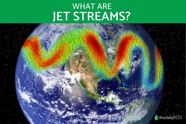
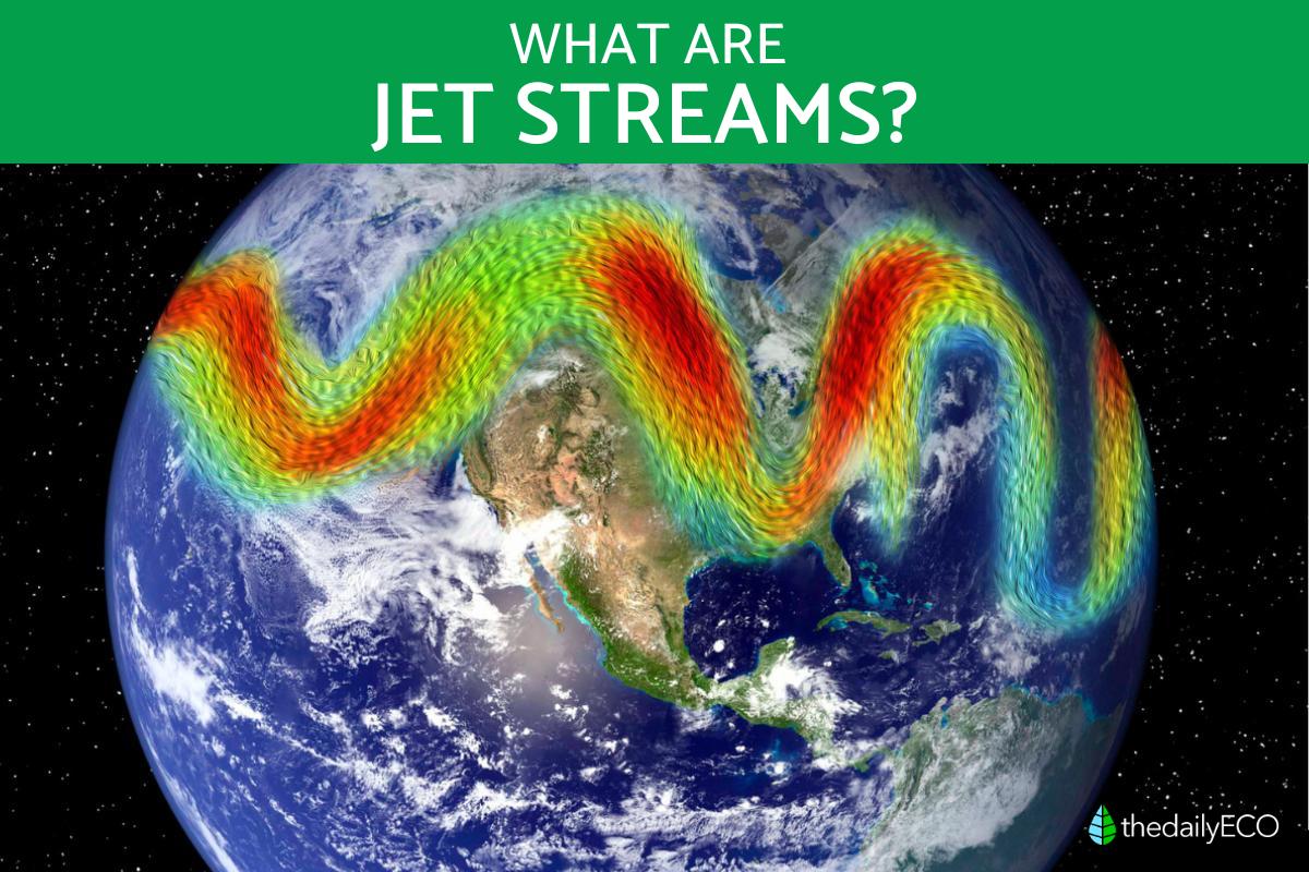
The jet stream is a high-altitude, fast-moving ribbon of air that encircles the Earth, influencing weather patterns and climate across continents. It steers storms, shifts temperatures, and creates distinct weather zones. Formed by temperature differences between the polar and tropical regions, the jet stream can change course, slow down, or intensify, impacting everything from seasonal rains to extreme weather events like droughts and cold snaps. .
In this article, you’ll get a clear look at what a jet stream is, its origins, how it functions, and its powerful impact on climate.
What is a jet stream and its characteristics
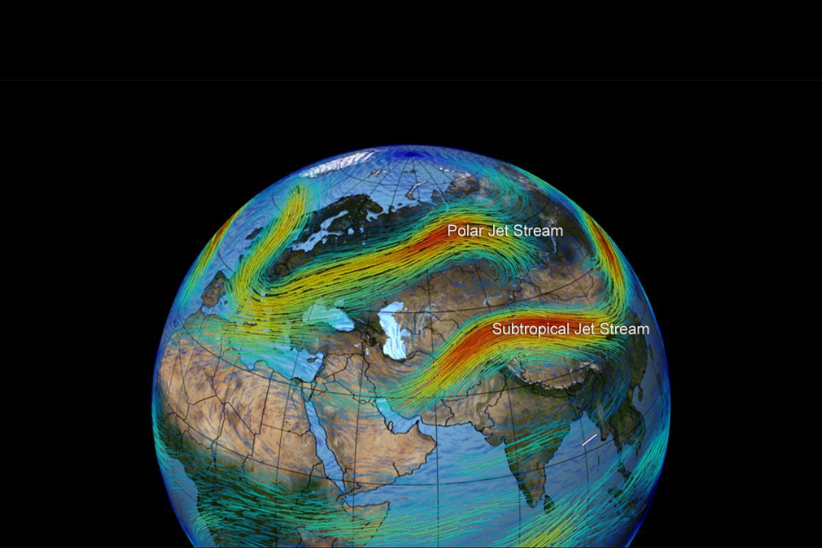
A jet stream is a fast, narrow band of winds high in the atmosphere, usually at the tropopause, the boundary between the troposphere and the stratosphere. Jet streams form due to temperature differences between air masses and often flow around the Earth in mid- to high latitudes.
- Speed: jet stream winds can reach 100 to 400 km/h (about 62 to 249 mph). Their speed depends on temperature and pressure differences between warm and cold air masses.
- Altitude: they flow at altitudes of 9 to 16 km (about 5.6 to 9.9 miles) above Earth’s surface, usually in the upper troposphere.
- Wavy pattern: jet streams form waves, known as Rossby waves. These waves affect weather, often moving cold and warm fronts and influencing storm development.
- Impact on weather: jet streams impact climate and weather. Their position and strength help shape storm paths and influence severe weather, like hurricanes and cyclones.
- Seasonal changes: jet streams shift in strength and position throughout the year. They tend to be stronger in winter due to more significant temperature differences between the equator and poles.
Interested in the bigger picture of how air moves around the globe? Discover the fascinating patterns driving our atmosphere.

When was the jet stream discovered?
The discovery of the jet stream unfolded gradually through the early 20th century, with early hints of its presence emerging even earlier. In 1883, German meteorologist and astronomer Hermann von Helmholtz hypothesized the existence of powerful, high-altitude air currents based on his studies of atmospheric fluids and meteorological observations.
In the 1920s, Japanese meteorologist Wasaburo Oishi became one of the first scientists to systematically study the jet stream. By releasing weather balloons over Japan, Oishi observed strong west-to-east winds at high altitudes, particularly over East Asia, and recorded these observations in groundbreaking work.
The jet stream gained further attention during World War II (1939-1945), when military pilots flying high-altitude missions encountered strong winds at the tropopause. This led to increased interest from scientists and meteorologists, who began to investigate these atmospheric patterns in detail.
By the late 1940s and 1950s, the jet stream was fully recognized and extensively studied by meteorologists worldwide. The advent of high-altitude aircraft, along with enhanced observational tools like weather balloons and the first weather satellites, significantly advanced our understanding of the jet stream's role in global weather patterns.
How a jet stream works
The jet stream is a fast-moving air current high in Earth’s atmosphere, created by temperature differences between polar and tropical air. Flowing west to east, it directs storms and affects temperature patterns. This section explains how the jet stream forms, moves, and impacts our weather:
- Temperature gradients: jet streams form where there are significant temperature differences between warm and cold air masses, such as between the colder polar air and warmer tropical air. These temperature contrasts create steep pressure gradients, driving the formation of jet streams.
- Coriolis Effect: earth's rotation deflects winds, causing jet streams to flow west-to-east rather than directly north-south. In the Northern Hemisphere, winds are deflected to the right, while in the Southern Hemisphere, they veer left.
- Tropopause boundary: the tropopause, the boundary layer between the troposphere and stratosphere, constrains vertical air movement, channeling winds into narrow, fast-moving bands that create jet streams.
- Geostrophic balance: jet stream winds are geostrophic, meaning they result from a balance between pressure gradient forces and the Coriolis effect. This balance allows winds to flow nearly parallel to isobars (lines of equal atmospheric pressure) rather than directly from high to low pressure zones.
- Rossby waves: jet streams exhibit a wavy pattern, known as Rossby waves, influenced by Earth's surface temperature variations, high and low-pressure systems, and other atmospheric factors. These waves create the undulating paths observed in jet streams and play a role in weather patterns.
Ready to unravel another mystery of the atmosphere? Learn how the Coriolis effect plays a pivotal role in our planet’s climate.

Importance of the jet stream
The jet stream plays a crucial role across meteorology, aviation, agriculture, and global weather studies:
- Climate regulation: jet streams act as atmospheric barriers, dividing distinct air masses. For instance, the polar jet stream separates frigid polar air from warmer air in mid-latitudes, influencing regional climates.
- Winter temperature variations: when the polar jet stream dips southward, it can pull cold Arctic air into warmer regions, leading to colder-than-usual winters. Conversely, if it shifts northward, typically cold regions may experience milder winters.
- Extreme weather patterns: undulations in the jet stream often create conditions for extreme weather, such as storms, hurricanes, heat waves, and cold spells, by forming strong cold and warm fronts.
- Weather forecasting: jet stream positions help forecasters identify areas likely to experience storms, heavy rainfall, or sudden temperature shifts. Understanding these patterns enhances both short- and long-term forecasting accuracy.
- Aviation efficiency: knowledge of jet stream dynamics enables pilots and flight planners to optimize routes, potentially saving fuel and reducing travel time.
- Agricultural impacts: shifts in the jet stream’s path or intensity can affect regional growing seasons, impacting agricultural production by altering temperature and precipitation patterns.
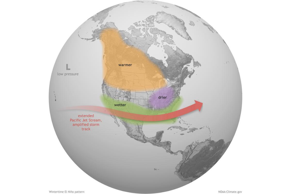
- Drought and flood risk: prolonged jet stream positioning can lead to extended droughts in some areas or persistent rainfall and flooding in others by concentrating storm activity in specific regions.
Explore how the jet stream and water systems are intertwined—discover more about what triggers floods and the outcomes that follow in this other article.
If you want to read similar articles to What Is a Jet Stream?, we recommend you visit our Meteorological phenomena category.
- Daniel Pizarro. 2019. Jet streams. The Ceuta lighthouse. Available at: https://elfarodeceuta.es/colaboracion-corrientes-chorro/
- SCRIBD. Corrientes Jet. Available at: https://es.scribd.com/document/172464169/Corrientes-Jet


